
The Dominion of Canada, to give it its full official name, has famously been called "The Great White North", this leading to that name being applied to a well-known comedy show.
Most of Canada does indeed lie to the north of most of the United States. And large areas of Canada do have a climate which is at least comparable to that of Siberia, although some remote and isolated portions of Siberia are even colder still.
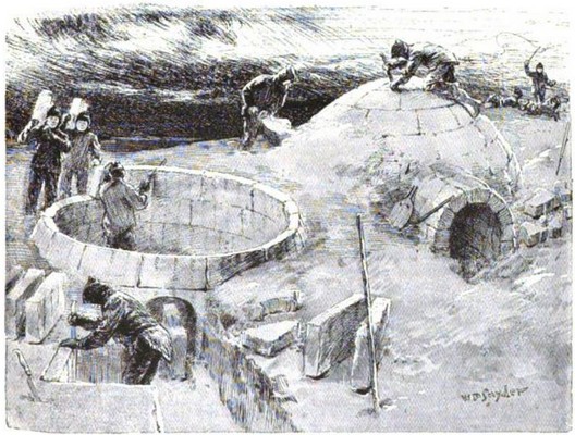
It is said that some Americans are so provincial that they think that Canadians live in igloos.
I suspect that this legend was formed due to errors made by very young children in the United States rather than adults. To be fair, however, the Inuktitut word iglu from which our English word "Igloo" is derived,
written as illustrated above, simply means "house", not referring specifically to the "snow igloo" or "ice igloo" which that word calls to our minds.
Canadians, by and large, therefore, live in houses or apartments with hot and cold running water, central heating, and which are wired for electricity.
And yet, the stereotype of Canada as a frozen wasteland is not entirely without foundation in fact.
Canada's three largest cities, Toronto, Montreal, and Vancouver, all lie very close to Canada's border with the United States. Some major cities in Western Canada are further north; Calgary, Saskatoon, and Edmonton, for example.
The Rocky Mountains are shared by Canada and the United States.
Despite the barrier posed by this mountain range, however, the entirety of the west coast of the "lower 48" portion of the United States is accessible by road and rail. Seattle, Portland, San Francisco, Los Angeles, and San Diego; all are reachable.
But on Canada's West Coast? With great effort and expense, a rail link to Prince Rupert, which lies just south of the Alaskan Panhandle, was constructed, and it is accompanied by a road link as well. The trip by rail to Prince Rupert is one of the most scenic Canadian rail journeys.
And the city of Vancouver is also connected to the rest of Canada by road and rail, along with the rest of the Lower Mainland portion of British Columbia, which includes such cities as Burnaby and New Westminster.
But between them, Canada's West Coast is only accessible by air and water.
Recently, it was in the news that flooding had cut off the Lower Mainland of British Columbia from the rest of Canada. This is quite uncommon. However, it is more common that stormy weather near Vancouver means that the ferry routes linking the city of Vancouver on the Canadian mainland to Vancouver Island are unable to operate.
On one recent occasion when this happened, commentators on the news noted that it would be quite impossible to link Vancouver Island to the Canadian mainland by building a bridge, as the distance involved would require a prodigous feat of engineering.
Here is an old map of British Columbia:
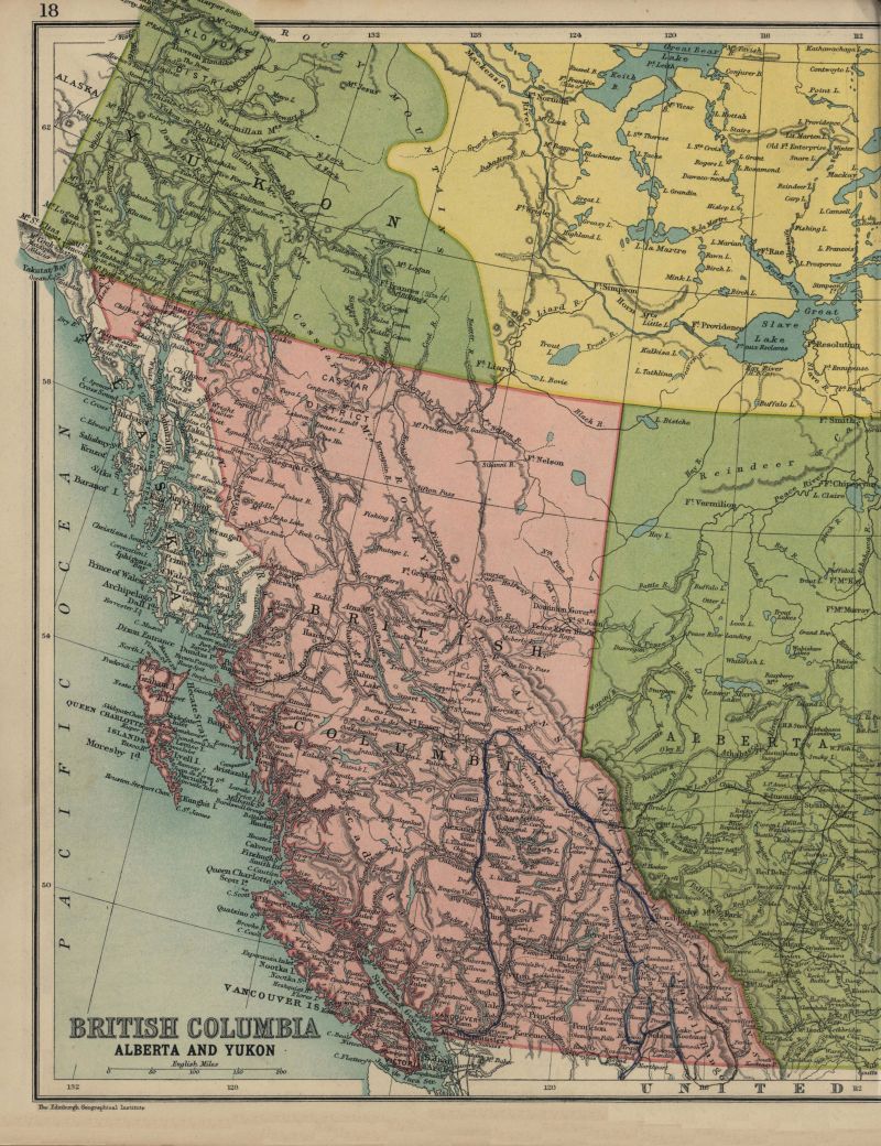
And let us look more closely at the portion which shows Vancouver Island:
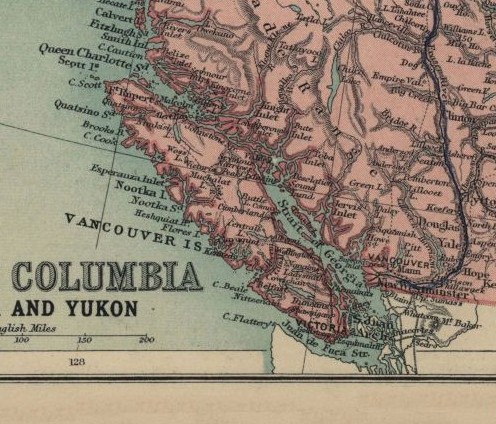
Clearly, building a bridge from the city of Vancouver to the nearest point on Vancouver Island, so as to allow a short drive from the city of Victoria, the capital of British Columbia, would indeed require spanning the Georgia Strait, and would indeed involve a nearly impossible feat of engineering.
But if you look further north, there is an area where the distances to be spanned are much smaller, as a group of closely packed small islands lie between Vancouver Island and the West Coast of Canada.
The trouble is, though, that as noted above, this portion of Canada's Western coastline is no less isolated from the rest of Canada as is Vancouver Island. So while such a bridge could be built, nothing would be gained from building it.
However, you may have noticed that there is another way in which Vancouver Island could be linked to the mainland of North America, if not to the rest of Canada, by bridges that might be feasible to construct...
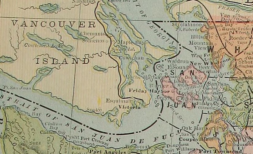
The islands of San Juan de Fuca within the Strait of San Juan de Fuca bring Vancouver Island closer to Washington State within the United States of America.
Examining a more detailed map, however, I think I have found a possible all-Canadian route. There are low-lying coastal areas all the way from Bliss Landing to Vancouver, and so there is a way to cross from Vancouver Island to mainland Canada which does not wind up in an area completely isolated by mountains.
Here is a map showing the sort of route I'm thinking of,
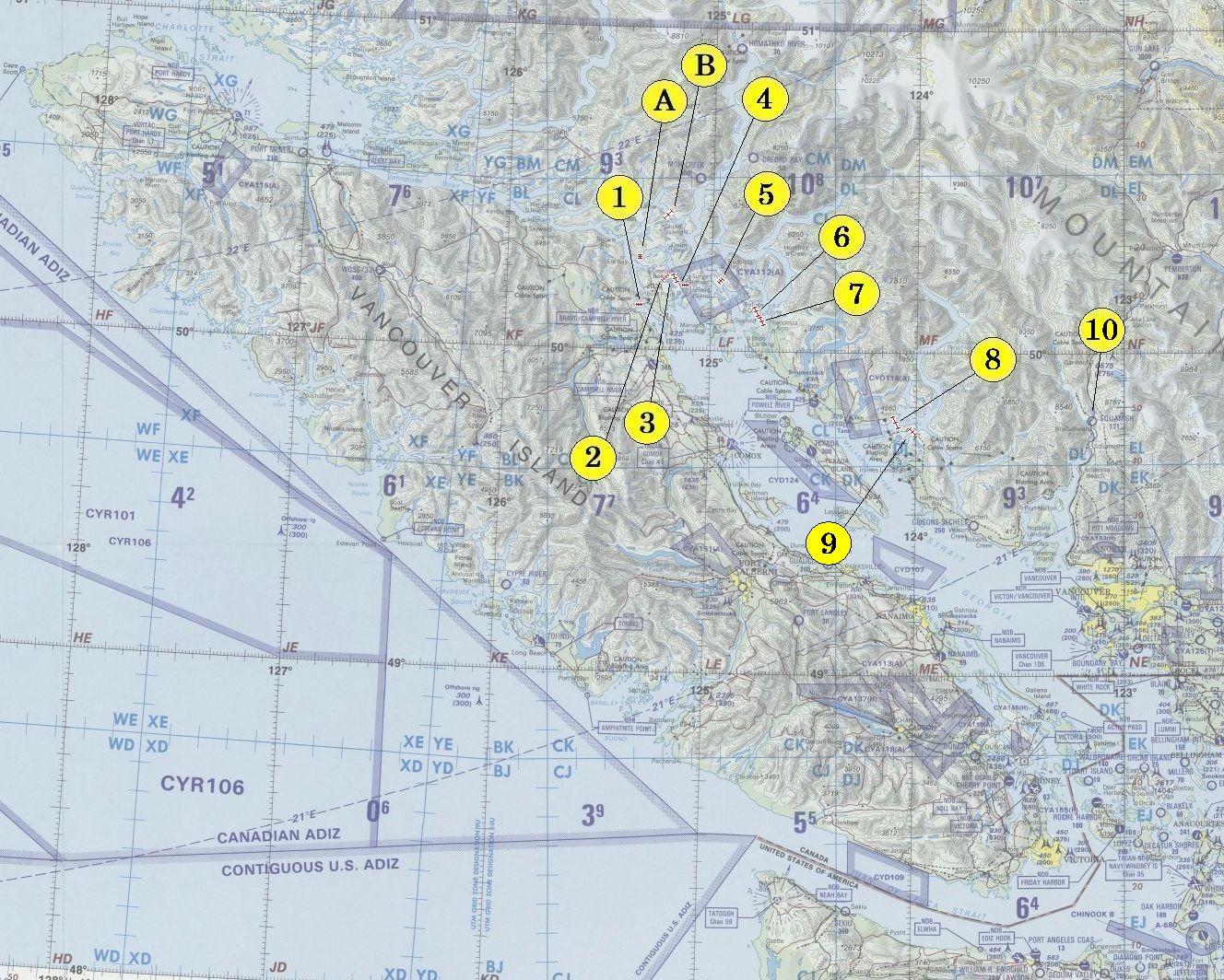
which I fancy is not absolutely impossible, even if it is still, of course, completely impractical. And I make no claims to being an expert at civil engineering, of course.
The components of the route as marked on the map are as follows:
Originally, several months ago, shortly after hearing about the ferries being unable to operate from Vancouver Island, I had been thinking somewhat differently about the issue.
I started with the same bridge (1) from Vancouver Island to Quadra Island, but then I continued with the bridge (A) to Sonora Island, and then the bridge (B) to the mainland just nort of Bute Inlet.
While that would have reached the mainland wilth only very short bridges, the portion of the mainland that was reached would have been completely isolated by mountains.
At one point, it seemed to me that the only other place on the Pacific coast of British Columbia that was connected to the rest of Canada by road was Prince Rupert, a port city just south of the Alaska Panhandle.
But that is not quite true. Bella Coola is a community on the British Columbia coast between Prince Rupert and Vancouver which has a road connection to the rest of Canada. However, that road connection is not of the best quality in some areas, and it is only slightly closer to where bridges from Vancouver Island might reach the coast of the mainland than is Vancouver. As well, there might not be an opportunity to build a road along the coast in that area.
Copyright (c) 2025, 2026 John J. G. Savard